Graves at Grange site? Archeologists haven’t found any yet
Published 5:53 pm Thursday, August 10, 2023

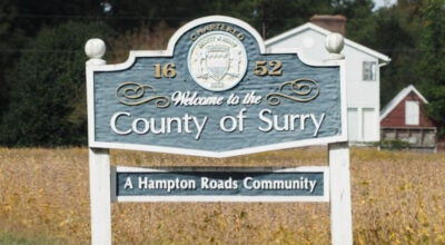
- This photo, included in the Thunderbird Archeology study submitted to the town, shows bricks lying in the dirt where the now-demolished 1730s Pierceville house once stood. (Image courtesy of Town of Smithfield)
Archeologists working for Grange at 10Main developer Joseph Luter IV have yet to find any gravesites associated with the 18th century farm on which proposed 304-home development would be built.
The Isle of Wight County Museum and developer’s archeological firm, however, have each recommended further study.
The roughly 57-acre site at Route 10 and Main Street is all that remains of the homestead of Thomas Pierce, a merchant who in 1730 purchased 300 acres in Smithfield that became known as “Pierceville.”
The late Smithfield historian Segar Cofer Dashiell wrote in a 1970 Smithfield Times column that when Pierce died in 1740, he bequeathed the land to his son, also named Thomas. The younger Thomas, a member of the 1788 Virginia Convention that ratified the U.S. Constitution, listed himself, his wife and child, and 22 enslaved Africans as residing at Pierceville as of the 1782 census.
Isle of Wight County Museum Director Jennifer England wrote in a Feb. 1 memorandum to the town that she deemed the potential for finding archeological artifacts at the Grange site “likely” and advised “determining the full extent of the parcel’s archaeological history is necessary before proceeding.”
“Gravesites may or may not be revealed, but as the parcel’s history dates prior to the 17th century, a full investigation is paramount,” England wrote.
The Grange development has also come to the attention of Preservation Virginia, a privately funded statewide organization dedicated to maintaining Virginia’s historic sites.
“While we understand the need for growth, we highly encourage you to require that the Pierceville site be fully investigated for archaeological deposits and burials before construction begins,” Sonja Ingram, associate director of the organization’s preservation field services, wrote to Smithfield’s Town Council on Aug. 1.
Preservation Virginia “has advocated for the preservation of Pierceville for a number of years,” the letter notes.
A multiyear campaign by town residents to save the nearly 300-year-old Dutch colonial Pierceville farmhouse ended in 2020 when Luter’s father, former Smithfield Foods Chairman Joseph Luter III, purchased the property and razed the home and an adjacent, abandoned grocery store.
Plans by Pierceville’s former owner, the late Mary Delk Crocker, to sell the land to a previous developer in 2015 met fierce opposition from area residents and ultimately fell through. In 2019, she sued the town over its denial that year of her request to demolish the dilapidated house, resulting in the court remanding the matter back to the Town Council for reconsideration. The court’s decision came on Nov. 12, 2020 – the same date the court recorded Crocker’s sale of the land to Luter III. On Dec. 1, 2020, the council voted to allow the demolition, which occurred nine days later.
What’s been done to locate graves?
In March and April 2021, Thunderbird Archeology conducted a “pedestrian reconnaissance” study of the site, which was submitted as part of Luter IV’s rezoning application package to the town.
According to Ivy Tan, a spokeswoman for the Virginia Department of Historic Resources, the term refers to essentially a “walk-over survey” where trained archeologists examine the ground for structural remains and artifacts visible from the surface.
According to Thunderbird’s report, a surveyor with the Depression-Era Works Progress Administration had, in 1937, noted the presence of “an old burying ground” on the property. Virginia Department of Transportation cultural resources staff had found historic artifacts in an area of the project site in 1995.
According to Preservation Virginia’s letter, two former slave dwellings were still standing at Pierceville as of the 1930s.
“Undoubtedly, the history and legacy of the property is tied to the history of the enslaved people of Smithfield,” Preservation Virginia’s letter states.
The land, according to Thunderbird’s report, was previously part of a grant from King Charles I to Joseph Cobb in 1637, but remained largely uninhabited by English settlers until the 18th century. The report lists nine known occupants of Pierceville, including the Pierces themselves, whose burial locations remain unknown.
“A lost family cemetery was likely present on the greater plantation if not necessarily within the project area,” Thunderbird’s report states.
The report states it’s also “likely that an unknown number of enslaved individuals were also buried on the plantation, either adjacent to the white owner’s cemetery or in a separate burial ground.”
Thunderbird’s researchers were unable to account for the gravesites of at least 62 enslaved people associated with Pierceville, according to the company’s report.
Pedestrian reconnaissance was unable to positively identify a cemetery location, though the report notes “possible displaced grave stones” near the western property boundary.
“The repeated plowing that has occurred on the property until the adoption of no-till agricultural practices in the latter half of the 20th century has greatly reduced the likelihood of identifying any former cemetery site within the field areas based upon the presence of depressions, mounds, or cemetery cultivars,” Thunderbird’s report states.
The report concludes by recommending a ground-penetrating radar, or GPR, survey.
An Aug. 23-24, 2022, survey by Forrest Environmental Services Inc. followed up by using 8-foot-deep GPR on four sites identified by Thunderbird.
The report states the GPR survey found three “anomalies” ranging from 3 feet to 6 feet below the surface, describing each as a “large mass of buried metal,” that was possibly an underground storage or septic tank. The report states Forrest Environmental found “no buried graves within the survey area.”
The Department of Historic Resources “did not have any involvement in the surveys,” according to Tan.
“Our project review division was contacted regarding compliance with Section 106 of the National Historic Preservation Act,” Tan said. “We determined that a Section 106 review was not needed for this project and therefore did not provide any input.”
Section 106 requires federal agencies to identify and assess the impact of projects with federal involvement may have on historic properties. A Section 106 review, according to the website for the federal Advisory Council on Historic Preservation that oversees the process, is only warranted if the property itself is federally owned or controlled, if the project is receiving federal grants or loans or if the project would require a federal permit or other approval. According to Preservation Virginia’s website, the Section 106 process relies heavily on public input from various parties, including state historic preservation offices.
What hasn’t been done yet?
Thunderbird and England have each recommended a “Phase I archeological survey.”
A Phase I survey, England explained, will delineate all the archeological resources in a project area.
“In order to fully determine which areas may have further information, should be avoided and/or are eligible for the National Register of Historic Places, such a survey is important,” England said.
According to Thunderbird’s report, a Phase I archeological survey was conducted by Maar Associates Inc. in 1993, but was “limited to a narrow corridor across the central portion of the site and along the southwestern boundary.”
Luter IV did not respond to the the Times’ Aug. 3 email inquiring about if or when a Phase I study would be performed.