Local impacts from Ian likely this weekend, coastal flood watch to begin Friday
Published 5:07 pm Wednesday, September 28, 2022
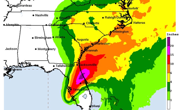
- The National Hurricane Center, as of Wednesday afternoon, predicts southeastern Virginia will receive four to six inches of rainfall over the next five days, with six to 10 inches possible in localities such as Isle of Wight and Surry counties that border the James River. Image courtesy of National Hurricane Center
Smithfield, Surry and surrounding areas are well outside Hurricane Ian’s projected path up the East Coast, but could still see impacts, according to the National Weather Service.
“We’re looking at a multi-day impact from Friday to early next week,” said NWS Meteorologist Eswar Iyer.
Ian made landfall Wednesday morning on Florida’s Gulf Coast with reported wind speeds of 155 mph, just shy of Category 5 strength. The cyclone, according to the National Hurricane Center, was expected as of Wednesday afternoon to downgrade to a tropical storm by Thursday morning and a depression by Saturday, cutting across Georgia, South Carolina and western North Carolina.
According to Iyer, there is still potential in Smithfield and its surrounding areas for wind gusts that could reach low-end tropical storm force Friday evening. The National Hurricane Center defines tropical storm wind speeds as 39 to 73 mph.
The NWS is currently estimating “several inches” of rainfall in the Smithfield area starting Friday evening and “continuing to next week,” Iyer said. The heaviest rainfall is expected to occur Friday evening into Saturday, with lighter rain Sunday.
“We’re expecting a long-duration tidal flooding, starting with high tide Friday afternoon,” Iyer said, adding that the flooding would likely build over the weekend and continue into next week over “multiple cycles.”
Coastal flood watch issued; Bacon Fest, Farmers Market canceled
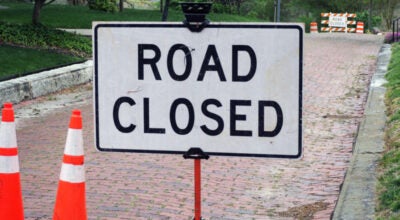
The National Weather Service has issued a coastal flood watch for Isle of Wight, Surry and James City counties and the cities of Suffolk and Newport News, which will begin Friday afternoon and continue through Friday evening. Around two feet of inundation above ground level is possible in low-lying areas near shorelines and tidal waterways. Numerous roads may be closed. If travel is required, the NWS advises motorists allow extra time and do not attempt to drive around barricades or through water of unknown depth.
As of Thursday morning, Saturday’s annual Bacon & Bourbon Fest at Windsor Castle in downtown Smithfield had canceled. There is no rain date for the festival, which had sold out, according to Smithfield VA Events’ website.
“Smithfield VA Events is truly disappointed to make this announcement,” the event’s Facebook page states. “We will be working with our cancellation insurance company to deliver any potential refunds possible within the terms dictated by our policy.”
Just prior to 11 a.m. Thursday, Smithfield and Isle of Wight County’s joint tourism department announced the Smithfield Farmers Market had also canceled due to the forecast of inclement weather. The Farmers Market, which operates weekly on Saturdays in the parking lot of the Bank of Southside Virginia’s parking lot on Main Street, is set to return Oct. 8.
Jamestown-Scotland Ferry interruptions possible
The Virginia Department of Transportation announced Thursday afternoon that starting as early as Friday, Sept. 30, the Jamestown-Scotland Ferry may experience intermittent service due to predicted high tide levels and sustained winds of up to 35 mph, with stronger wind gusts possible.
The highest potential for service interruptions begins early Friday afternoon through Sunday, Oct. 2, potentially impacting daily and overnight commutes. According to VDOT, high water caused by higher than normal tide levels prevents the loading ramps on the docks from safely being raised and lowered onto the ferry boats.
“If service is reduced or suspended, it will be restored as soon as waters recede, allowing ramps to be safely secured for loading vehicles,” VDOT’s press release states.